Titan's Hidden Ocean: Ammonia Keeps Water Liquid
Titan's Hidden Ocean: Ammonia Keeps Water Liquid

Mimas: How Saturn's Death Star Moon Hides an Ocean

How Solar Sails Tack on Sunlight Like Ocean Ships

Eta Carinae's Great Eruption Rewrites Stellar Death

Shkadov Thruster: The Giant Mirror That Could Move Stars

Pulsed Plasma Thrusters: 1960s Tech Gives CubeSats Precision
TL;DR: Valles Marineris, the solar system's largest canyon, formed when the massive Tharsis volcanic bulge cracked Mars's crust 3.5 billion years ago. Tectonic rifting, gravitational collapse, and possible water erosion shaped this 4,000-kilometer scar, which continues to reveal secrets through modern orbital missions.
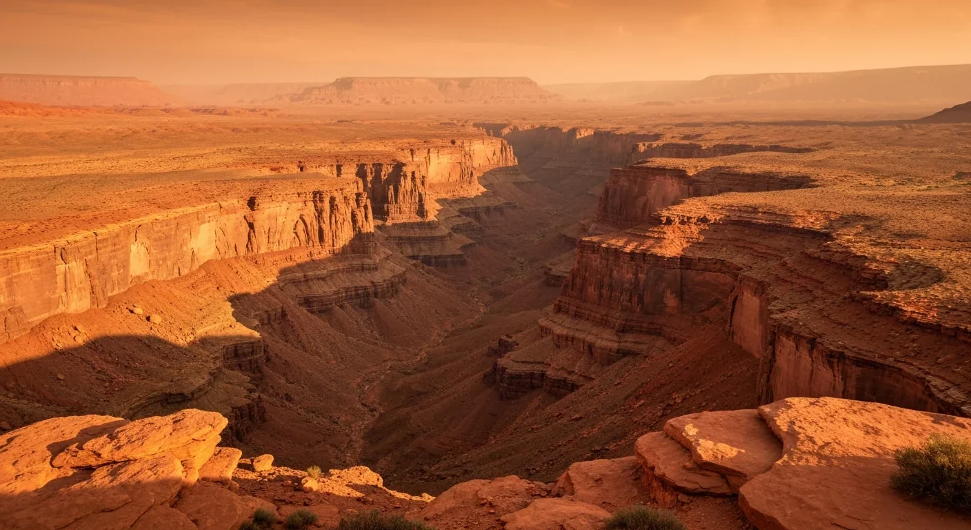
Imagine standing on the edge of a crack so vast it could swallow the entire continental United States from coast to coast. That's Valles Marineris, the single most dramatic scar on any planet in our solar system, and the story of how it got there reads like a geological thriller spanning billions of years. This isn't some slow, patient river carving through rock the way the Colorado shaped the Grand Canyon. Mars essentially tore its own crust apart, and what it left behind is a canyon system so enormous it makes every geological feature on Earth look modest by comparison.
Numbers don't always land with the punch they deserve, so let's make these real. Valles Marineris stretches roughly 4,000 kilometers along the Martian equator, which is about the distance from New York City to Los Angeles. At its widest, it spans up to 600 kilometers, a gap so broad you could drop several Grand Canyons side by side and still have room. The depth reaches 7 to 8 kilometers in places, nearly four times deeper than Arizona's famous gorge, which bottoms out at roughly 1.8 kilometers.
The system isn't a single trench, either. It's a network of interconnected chasms, each with its own personality. Coprates Chasma runs long and relatively straight, while Candor Chasma houses enormous layered deposits that have fascinated planetary scientists for decades. Ophir, Melas, and Ius Chasmata each tell slightly different stories about the forces that shaped them. The whole system extends from the Noctis Labyrinthus fracture zone in the west to chaotic, jumbled terrain in the east, where ancient floodwaters once burst free toward the northern lowlands.
If you took a cross-section through these canyon walls, you'd be looking at a geological time capsule. Billions of years of Martian history sit exposed in those layered rocks, a record that orbital cameras and spectrometers are still working to decode.
So what ripped Mars open? The answer starts with Tharsis, a volcanic province so massive it warped the entire planet. The Tharsis bulge rises roughly 10 kilometers above the surrounding terrain, a continent-sized dome built by billions of years of volcanic activity. Olympus Mons, the solar system's tallest volcano, sits at its western edge. But Tharsis didn't just build mountains. Its sheer weight and the upward push of the magma beneath it stressed the surrounding crust to its breaking point.
Think of it this way: if you push up on the center of a thin sheet of ice, the surface around the dome cracks. That's essentially what happened on Mars, but at a planetary scale. The extensional strain radiating from Tharsis pulled the crust apart along the equator, and Valles Marineris is the surface expression of that tremendous stretching.
This process kicked into gear around 3.5 billion years ago, during the late Noachian to early Hesperian period of Martian history. That timing matters because it overlaps with a period when Mars was still geologically active, with volcanism, possible surface water, and a thicker atmosphere all playing roles in shaping the planet.
The Tharsis volcanic province is so massive that its weight alone was enough to buckle the Martian crust and create a network of extensional faults spanning thousands of kilometers.
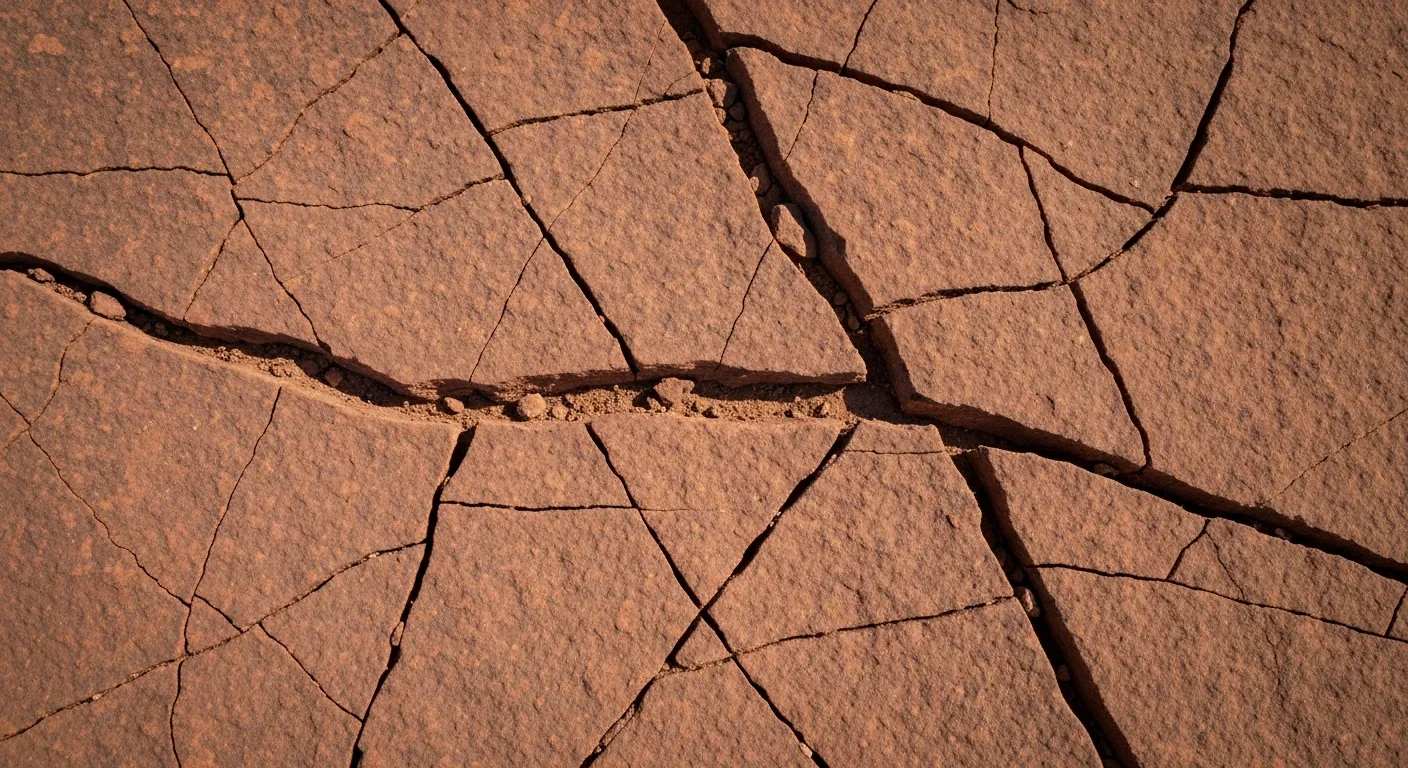
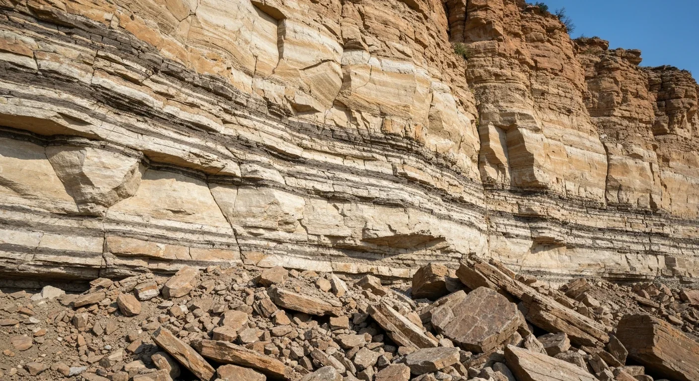
The actual mechanics of Valles Marineris start with a process geologists call extensional faulting. As the crust was pulled apart, blocks of rock dropped downward along parallel fractures called normal faults. The sunken blocks formed grabens, valley-like depressions bordered by steep fault scarps on each side. Picture a keystone dropping out of an arch, but stretched across thousands of kilometers.
These grabens are the skeletal framework of Valles Marineris. The faults typically dip toward the center of the graben from both sides, creating the classic trough-shaped profile that shows up in MOLA topographic maps. Some sections show half-graben geometry, where one fault dominates, producing an asymmetric profile with a steep wall on one side and a gentler slope on the other.
On Earth, we see the same process at work in the East African Rift, where the African plate is slowly splitting apart. The Rhine Valley in Germany and Utah's Basin and Range Province are other examples of extensional graben systems. The Moab Fault in southeastern Utah provides a particularly useful analog: an extensional fault with displacements up to 960 meters and well-documented fault transfer zones where displacement shifts from one segment to another. Similar segmentation shows up in the architecture of Valles Marineris, where dense faulting at transfer zones helped link individual chasms into a continuous system.
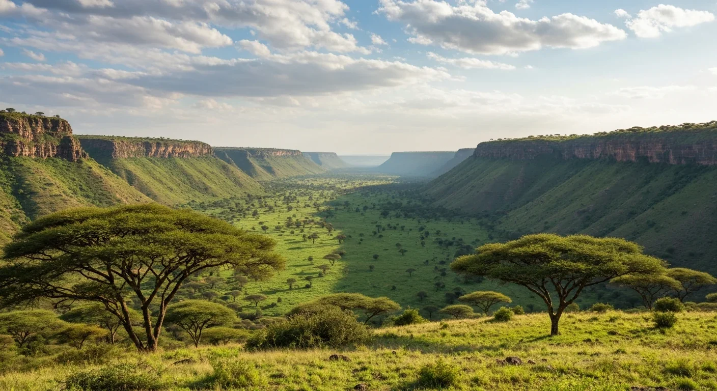
But here's what makes Mars different. On Earth, rift systems can eventually evolve into new ocean basins. The East African Rift may one day split the continent and create a new sea. Mars never got that far. Without active plate tectonics, the Martian rift stalled. There was no spreading center, no new crust forming in the gap. Instead, the rift just sat there for billions of years, slowly being reshaped by other forces.
Initial rifting created the basic structure, but what happened next made Valles Marineris truly spectacular. The canyon walls, weakened by faulting and standing at tremendous heights, began to fail under their own weight. Gravitational collapse sent enormous sections of wall rock tumbling to the canyon floor, widening and deepening the system far beyond what faulting alone could achieve.
The scale of these collapses is staggering. Some landslide deposits extend over 100 kilometers in length, ranking among the largest mass movements anywhere in the solar system. For context, the largest landslides on Earth typically run a few tens of kilometers at most. On Mars, with its lower gravity, wall collapses could travel much farther across the canyon floor.
"Some landslide deposits within the canyon extend over 100 km in length, ranking among the largest mass movements in the solar system."
- Mars Express HRSC and MOLA elevation data analysis
Data from the Viking orbiters' Infrared Thermal Mapping experiment revealed areas of high thermal inertia throughout the canyon interior, suggesting the floor is littered with large blocks and boulders from these collapse events. More recently, ground-penetrating radar from Mars Express MARSIS and MRO SHARAD has probed up to 5 kilometers below the surface, revealing layered subsurface structure that tells the story of repeated episodes of collapse and infilling.
The alternating layers visible in HiRISE images of the canyon walls add another dimension to this story. Hard volcanic strata alternate with softer ash and sedimentary layers, reflecting episodic volcanic outbursts separated by quieter periods of deposition. When landslides sheared through these alternating layers, they created the dramatic, staircase-like wall profiles visible in orbital imagery today.
Then there's water. Mars and water have a complicated relationship, and Valles Marineris sits right at the center of that debate. Multiple lines of evidence suggest that water played a role in shaping the canyon, though scientists still argue about how much and when.
The most compelling evidence comes from spectroscopy. ESA's Mars Express and NASA's Mars Reconnaissance Orbiter have detected hydrated sulfate minerals in the canyon walls, including jarosite and gypsum. These minerals only form in the presence of water. The European Space Agency's instruments also found evidence of epsomite and kieserite, further strengthening the case that liquid water once interacted with the rocks inside Valles Marineris.
The interior layered deposits found on the floor of Candor Chasma and other sections may represent sediments laid down in ancient lakes that once filled parts of the canyon. If confirmed, these lakes would have been enormous, constrained by canyon walls towering kilometers above the water surface.
At the eastern end of the system, the landscape dissolves into chaotic terrain, a jumble of fractured, collapsed blocks that mark the headwaters of massive outflow channels. These channels, which once carried catastrophic floods toward the northern lowlands and Chryse Planitia, suggest that enormous volumes of water were released suddenly, possibly from subsurface aquifers destabilized by the very tectonic and collapse processes that formed the canyon itself.
Hydrated sulfate minerals like jarosite and gypsum found in the canyon walls provide some of the strongest evidence that liquid water once flowed through Valles Marineris, potentially forming ancient lakes within the chasms.
The temporal overlap is suggestive. During the Hesperian period, when cryospheric freezing was locking water underground as ice, episodic releases may have coincided with major collapse events. Picture this: tectonic faulting breaches a subsurface aquifer, water floods into the canyon, undermines the walls, triggers more collapse, which releases more water. It's a feedback loop that could explain some of the canyon's most dramatic features.
Every new mission to Mars adds resolution to this picture. The Mars Orbiter Laser Altimeter (MOLA) on Mars Global Surveyor produced definitive topographic maps that finally allowed scientists to measure the canyon's true dimensions and identify structural features hidden by dust and shadow. MOLA cross-sections revealed the depth of faulting and the geometry of individual chasmata with unprecedented precision.

The Mars Express HRSC camera brought high-resolution stereo imaging to the canyon walls, revealing stratigraphic details invisible to earlier missions. Layer-by-layer analysis of the exposed rock has helped reconstruct the sequence of volcanic, sedimentary, and collapse events that built up and then carved away the canyon over billions of years.
Meanwhile, spectroscopic instruments like OMEGA on Mars Express and CRISM on MRO have mapped the mineral composition of the canyon in detail, identifying not just where hydrated minerals occur but what specific minerals are present, each one a clue to the chemical conditions that prevailed when it formed.
Valles Marineris teaches us something profound about how rocky planets work. On Earth, we tend to think of plate tectonics as the primary driver of geological change. Continents drift, ocean basins open and close, mountains rise where plates collide. Mars never developed that system. Its crustal stresses were accommodated through large, isolated tectonic events rather than the continuous recycling of crust that defines Earth's geology.
Yet even without plate tectonics, Mars produced a rift system that dwarfs anything on our planet. That tells us that volcanic loading and crustal extension alone can generate extraordinary geological features, and it forces planetary scientists to think beyond the Earth-centric models that dominated early Mars research.
The canyon also serves as a natural laboratory. Because Mars lacks the weathering and tectonic overprinting that constantly reshapes Earth's surface, Valles Marineris preserves a record of early planetary processes that has long been erased on our own world. Its exposed walls are essentially a cross-section through 3.5 billion years of Martian crustal evolution, from the oldest basement rocks to relatively recent dust deposits.
"Valles Marineris demonstrates how a single, large-scale marginal rift can evolve into a complex scar through a sequence of tectonic rifting, gravitational collapse, and erosional modification, all within a planet that lacks active plate tectonics."
- Planetary geology synthesis from orbital data analysis
For all that spacecraft have revealed, major questions remain. How deep does the extensional deformation actually extend beneath Valles Marineris? Answering that would constrain Mars's lithospheric thickness and thermal history. What's the precise temporal relationship between the alternating volcanic and sedimentary layers and the massive landslides that cut through them? Did the landslides truncate older strata, or did sedimentation resume after each collapse?
And then the big one: did Valles Marineris actually host lakes, and if so, for how long? The mineral evidence points toward water, but mineral detection from orbit can't tell us whether we're looking at a lake that persisted for millions of years or brief groundwater seeps. A rover mission into one of the chasmata could potentially settle that question by examining the layered deposits up close.
Future missions carrying next-generation radar and seismometers could probe the subsurface architecture that remains invisible to cameras. Understanding the full three-dimensional structure of the rift would reveal not just how the canyon formed, but what's happening beneath it right now, and whether Mars retains any residual geological activity at all.
Valles Marineris isn't just a scenic feature for future tourists to gawk at. It's a 4,000-kilometer-long geological textbook, and we've only read the first few chapters. Every new instrument we send to Mars opens another page, and the story keeps getting more interesting.
Saturn's moon Titan may harbour liquid water beneath its frozen crust, kept from freezing by ammonia acting as a natural antifreeze. New Cassini data suggests the interior could be slush with warm water pockets rather than a global ocean, and NASA's Dragonfly mission launching in 2028 aims to investigate whether this exotic environment could support life.

The cerebellum, long dismissed as merely a motor coordinator, forms dense circuits with the prefrontal cortex that shape cognition and emotion. Disruption of these pathways is now linked to schizophrenia, autism, and ADHD, opening new frontiers in diagnosis and non-invasive brain stimulation therapies.

Research shows the sharing economy often increases total resource consumption through the Jevons paradox and rebound effects. Ride-sharing adds billions of vehicle miles, co-working spaces use more energy per worker, and diffused responsibility erodes conservation behavior. Breaking the paradox requires congestion pricing, accountability design, and matching sharing models to appropriate resource types.

Illusory superiority causes most people to rate themselves above average in driving, intelligence, and ethics. This bias is rooted in metacognitive blind spots, shaped by culture, and carries real costs in healthcare, finance, and leadership. Structured feedback and institutional safeguards can help, but require ongoing effort.

Eastern skunk cabbage generates its own body heat through the alternative oxidase pathway, maintaining temperatures up to 35°C above freezing air and melting surrounding snow. This thermogenic ability, shared by roughly 90 plant species worldwide, reveals a level of metabolic sophistication that challenges assumptions about plant passivity.

America has 28 vacant homes for every homeless person, yet homelessness hit record highs in 2024. Speculative investment, geographic mismatches, and political barriers explain the paradox, while Finland and Vienna show that Housing First and social housing models can work when the political will exists.

Wafer-on-wafer bonding fuses logic and memory silicon at the atomic level, delivering up to 100x interconnect density over traditional packaging. TSMC, Intel, and Samsung are racing to commercialize the technology as AI chips hit the memory bandwidth wall.

Loading featured articles...