Titan's Hidden Ocean: Ammonia Keeps Water Liquid

Titan's Hidden Ocean: Ammonia Keeps Water Liquid

Mimas: How Saturn's Death Star Moon Hides an Ocean

How Solar Sails Tack on Sunlight Like Ocean Ships

Eta Carinae's Great Eruption Rewrites Stellar Death

Shkadov Thruster: The Giant Mirror That Could Move Stars
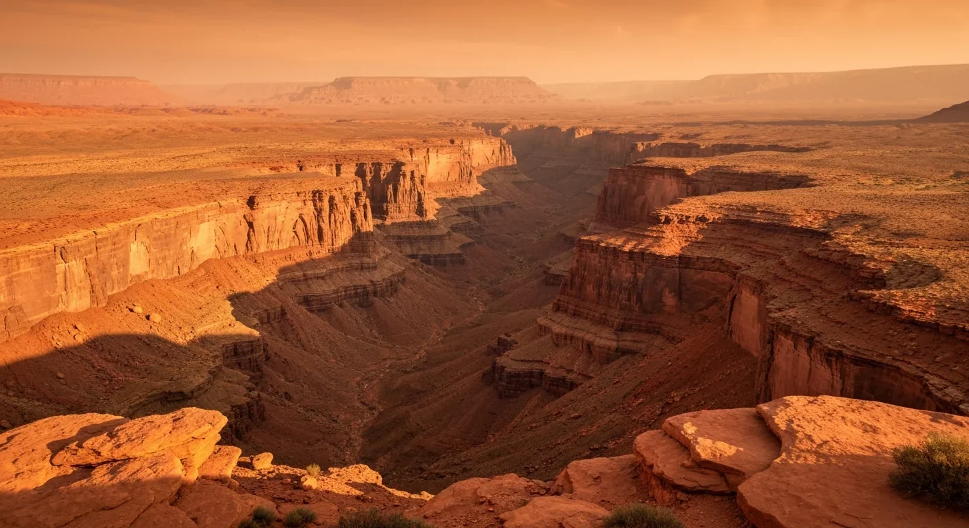
How Mars Ripped Open: Forces Behind Valles Marineris
TL;DR: Satellites equipped with LiDAR, multispectral imaging, and radar are revealing hidden ancient cities, irrigation systems, and settlements invisible from the ground, transforming archaeology from an elite pursuit into a democratized science powered by AI and accessible to citizen scientists worldwide.
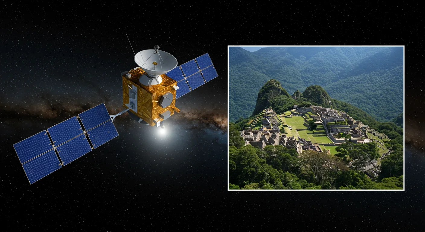
The jungle canopy stretches endlessly beneath the satellite, a seamless carpet of green masking secrets that have slept for centuries. Then the data comes in: LiDAR pulses piercing through vegetation, revealing thousands of hidden structures where archaeologists once saw only trees. What looked like wilderness from the ground transforms into a sprawling network of temples, highways, and hydraulic systems. This is space archaeology, and it's rewriting everything we thought we knew about ancient civilizations.
We're witnessing a paradigm shift in how we uncover the past. The same satellites that guide our GPS and forecast tomorrow's weather are now peeling back millennia of concealment, exposing lost cities, irrigation networks, and settlement patterns that traditional archaeology would take generations to find.
The marriage of space technology and archaeology began in the 1970s, when early Landsat satellites captured multispectral images of Earth's surface. These first-generation satellites had a resolution of 60 meters - barely enough to spot large buildings, let alone buried ruins. Yet even with this limited vision, archaeologists noticed something intriguing: ancient structures left subtle signatures in vegetation patterns and soil moisture.
Fast forward five decades, and the transformation is staggering. Modern satellites like WorldView-2 can resolve features as small as one meter, while the upcoming SatLeo Labs constellation promises visible imagery at 10-centimeter resolution. That's a sixty-fold improvement in detail, compressing decades of evolution into a single generation.
But resolution tells only part of the story. The real revolution came when archaeologists learned to see beyond the visible spectrum. Multispectral sensors detect infrared wavelengths that reveal crop stress over buried walls, while synthetic aperture radar penetrates clouds to map terrain. LiDAR became the game-changer, emitting pulsed laser beams that strip away foliage to reveal the naked ground beneath.
Understanding how satellites uncover ancient sites requires grasping three complementary sensing technologies, each with unique superpowers for archaeological detection.
Multispectral imaging works like having Superman's vision across dozens of wavelengths simultaneously. Plants growing over buried structures absorb water differently than surrounding vegetation, creating "crop marks" invisible to the naked eye but glaringly obvious in near-infrared bands.
LiDAR penetrates the impenetrable. In regions where dense jungle conceals everything at ground level, LiDAR systems emit millions of laser pulses per second - the RIEGL VUX-160 records 2.4 million measurements per second. Sophisticated algorithms separate returns from leaves, lower canopy, and bare earth, creating precise 3D terrain models that reveal ancient roads and building foundations hidden beneath rainforest.
Synthetic Aperture Radar (SAR) sees through more than vegetation. Operating at microwave frequencies, SAR penetrates clouds and operates day or night, making it invaluable for monitoring tropical regions. NASA's NISAR satellite uses L-band radar with a 10-inch wavelength to capture objects as small as 15 feet.
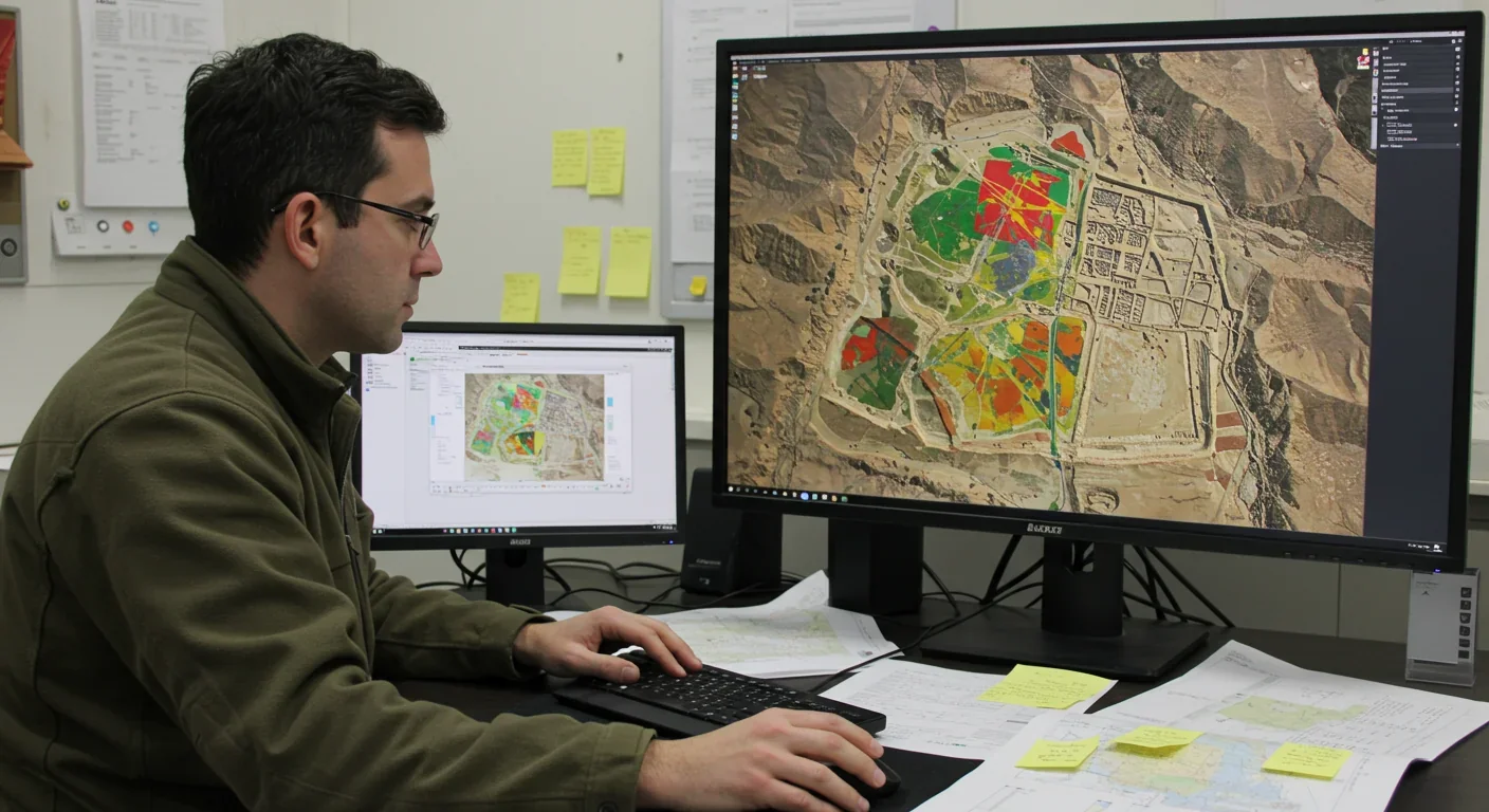
The magic happens when these technologies combine. A multi-method workflow - integrating GIS analysis, unsupervised classification, and statistical modeling - dramatically improves detection confidence compared to single-sensor approaches.
For generations, archaeologists mapped Angkor Wat and its surroundings, believing they understood the Khmer Empire's greatest city. Then LiDAR changed everything. A 2015 survey revealed that Angkor was a sprawling urban complex covering more than 1,000 square kilometers - roughly the size of Los Angeles. The data exposed an intricate hydraulic system of moats, channels, reservoirs, and barays that sustained perhaps a million people.
Nearby Banteay Chhmar told an equally surprising story. LiDAR revealed almost no evidence of a formal urban grid, contradicting assumptions that all major Khmer cities followed Angkor's planned layout. The integration of GIS with LiDAR data enabled archaeologists to map population movement patterns, offering unprecedented insights into how ancient societies adapted to environmental pressures.
Peru's Nazca Lines have fascinated researchers since their discovery, but satellite imagery added unexpected complexity. Analysis of Landsat 5 data and aerial photography revealed the geoglyphs' distribution extends roughly twice the officially documented area, with faded lines stretching far beyond UNESCO's protected boundaries.
More provocatively, the satellite analysis suggested only a small portion of geoglyphs may be genuinely ancient, with the majority created within the last few centuries. Beyond the famous figures, researchers discovered networks of irrigation channels linked to trapezoidal structures, implying sophisticated water diversion systems that transformed desert into productive agricultural land.
In Tunisia's sandy wastes, archaeologists used WorldView-2's one-meter resolution imagery to reconstruct Rome's defensive frontier. By combining three feature-extraction methods, researchers reconstructed the military fort system along the ancient limes. Field surveys confirmed the satellite-detected sites, many never previously recorded.
If satellites provide the eyes to peer into history, artificial intelligence gives them cognitive power to recognize what they're seeing. Traditional imagery analysis meant archaeologists manually scrutinizing thousands of images - a process so time-consuming that vast archives sat unexamined. AI changed that equation.
Machine learning models trained on known sites can now scan millions of square kilometers, flagging potential archaeological features for human review. A deep learning system trained on Maya settlements detected over 60,000 previously unknown features in the Yucatan Peninsula. In Guatemala's Petén forest, AI algorithms applied to LiDAR point clouds revealed thousands of structures, fortifications, and elevated highways.
Hybrid CNN-GRU neural networks applied to Sentinel-2 satellite imagery achieve 99% accuracy in classifying landscape features - a capability easily adapted to detecting anomalies associated with buried archaeological sites. AI systems can even predict locations of Roman roads by combining settlement locations with topographic features.
Yet for all its power, AI remains a complement, not a replacement, for human expertise. Algorithms excel at pattern recognition but lack the contextual knowledge and critical thinking that trained archaeologists bring to interpreting finds.
The newest satellite constellations integrate AI directly onboard spacecraft. SatLeo Labs' microsatellites incorporate edge computing modules with AI-powered models that translate raw sensor data into predictive intelligence in real time, dramatically reducing latency.
The future of space archaeology shines with possibility. SatLeo Labs represents the coming generation. Operating in low Earth orbit, the constellation will provide continuous global thermal monitoring twice daily, with thermal imaging at 10-meter resolution and visible imagery at 10 centimeters. The thermal accuracy of approximately one Kelvin enables detection of subtle temperature differences that reveal buried structures.
NASA and ISRO's NISAR mission showcases another frontier. Combining L-band and S-band synthetic aperture radar, NISAR will monitor Earth's land and ice surfaces every 12 days, providing systematic coverage that tracks changes to archaeological sites threatened by development or climate change.
The Landsat program's uninterrupted time series from 1972 to today offers another kind of power: the ability to track environmental changes across decades. Landsat 9, launched in 2021, continues this legacy with 30-meter optical bands - modest compared to commercial satellites but unmatched for long-term monitoring.
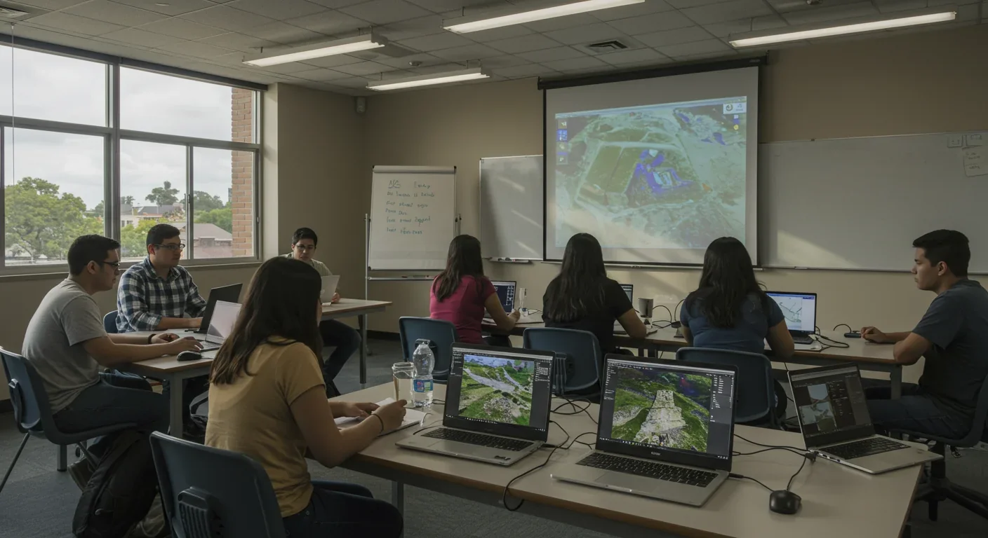
Democratization may prove more revolutionary than any sensor upgrade. Landsat imagery is freely available through USGS EarthExplorer, enabling students and hobbyists to access the same data professionals use. Citizen science initiatives allow non-specialists to contribute to genuine discoveries, crowdsourcing analysis at scales impossible for academic teams alone.
You don't need a PhD or a satellite to participate in space archaeology. Multiple platforms welcome citizen scientists eager to help unlock ancient mysteries.
Start with the data: USGS EarthExplorer provides free access to the entire Landsat archive, along with data from numerous other satellites. ESA's Copernicus Open Access Hub offers Sentinel satellite imagery.
Learn the tools: Open-source software like QGIS enables geographic analysis without expensive licenses. Tutorials abound online, teaching remote sensing basics, image processing, and feature identification.
Join a project: Several citizen science platforms actively recruit volunteers. While specific archaeology-focused initiatives come and go, the model thrives - participants review satellite images flagging potential sites for expert verification.
Understand the ethics: With power comes responsibility. Publishing satellite imagery of previously unknown sites can attract looters rather than legitimate archaeologists. Local engagement promotes protection better than external surveillance. Responsible space archaeology balances discovery with preservation.
The field bridges multiple disciplines - archaeology, remote sensing, computer science, environmental science - creating opportunities for diverse skill sets. Programmers can develop better AI detection algorithms. Data scientists can refine classification models. Educators can communicate discoveries to wider audiences.
Space archaeology does more than find lost cities. It changes how we understand ourselves. When satellites reveal that Angkor supported a million people with sophisticated water management, or that Nazca engineers transformed deserts into farmland, we recognize ancient peoples' ingenuity with fresh clarity.
The view from orbit also reveals fragility. Climate change and development threaten heritage sites faster than traditional archaeology can document them. Satellite monitoring provides early warning, tracking encroachment and deterioration that might otherwise go unnoticed until destruction is irreversible.
Perhaps most profound is the democratization of discovery. For centuries, archaeology was an elite pursuit, data locked in institutions. Open satellite archives break these barriers, enabling a high school student in Mumbai or a retiree in Montana to contribute meaningful research.
The technology will keep improving - resolution sharpening, AI growing more sophisticated, sensor suites expanding. But the fundamental shift has already happened. We've gained the ability to see our planet, and our past, with unprecedented clarity. Every orbit unveils secrets. Every pass of LiDAR through jungle canopy rewrites textbooks.
The ancient world is no longer hidden. It's simply waiting for us to look up - or rather, to look down from the vantage point satellites provide. And what we find there, in the shadows and soil signatures and subtle temperature variations, is ourselves: resourceful, creative, enduring, and far more capable than the ruins alone suggest.
Saturn's moon Titan may harbour liquid water beneath its frozen crust, kept from freezing by ammonia acting as a natural antifreeze. New Cassini data suggests the interior could be slush with warm water pockets rather than a global ocean, and NASA's Dragonfly mission launching in 2028 aims to investigate whether this exotic environment could support life.

The cerebellum, long dismissed as merely a motor coordinator, forms dense circuits with the prefrontal cortex that shape cognition and emotion. Disruption of these pathways is now linked to schizophrenia, autism, and ADHD, opening new frontiers in diagnosis and non-invasive brain stimulation therapies.

Research shows the sharing economy often increases total resource consumption through the Jevons paradox and rebound effects. Ride-sharing adds billions of vehicle miles, co-working spaces use more energy per worker, and diffused responsibility erodes conservation behavior. Breaking the paradox requires congestion pricing, accountability design, and matching sharing models to appropriate resource types.

Illusory superiority causes most people to rate themselves above average in driving, intelligence, and ethics. This bias is rooted in metacognitive blind spots, shaped by culture, and carries real costs in healthcare, finance, and leadership. Structured feedback and institutional safeguards can help, but require ongoing effort.

Eastern skunk cabbage generates its own body heat through the alternative oxidase pathway, maintaining temperatures up to 35°C above freezing air and melting surrounding snow. This thermogenic ability, shared by roughly 90 plant species worldwide, reveals a level of metabolic sophistication that challenges assumptions about plant passivity.

America has 28 vacant homes for every homeless person, yet homelessness hit record highs in 2024. Speculative investment, geographic mismatches, and political barriers explain the paradox, while Finland and Vienna show that Housing First and social housing models can work when the political will exists.

Wafer-on-wafer bonding fuses logic and memory silicon at the atomic level, delivering up to 100x interconnect density over traditional packaging. TSMC, Intel, and Samsung are racing to commercialize the technology as AI chips hit the memory bandwidth wall.

Loading featured articles...